
Muskogee topographic map
Click on the map to display elevation.
Muskogee
Muskogee lies in the Arkansas River Valley and has a low, sea-level elevation compared to much of the rest of the state. The city is on the boundary of the oak and hickory forest region of eastern Oklahoma and the prairie, Great Plains region of northeastern Oklahoma. It is a suburban community of Tulsa.
About this map
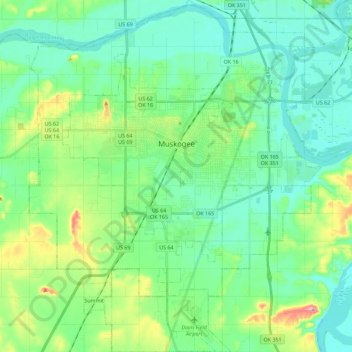
Name: Muskogee topographic map, elevation, terrain.
Location: Muskogee, Muskogee County, Oklahoma, United States (35.63865 -95.46477 35.82257 -95.27636)
Average elevation: 577 ft
Minimum elevation: 476 ft
Maximum elevation: 892 ft
Muskogee County trails, hiking, mountain biking, running and outdoor activities