

Ilo'ilo topographic map
Click on the map to display elevation.
About this map
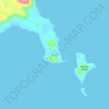
Name: Ilo'ilo topographic map, elevation, terrain.
Location: Ilo'ilo, Milne Bay, Southern Region, Papua New Guinea (-10.70852 150.40572 -10.66852 150.44572)
Average elevation: 16 ft
Minimum elevation: -7 ft
Maximum elevation: 449 ft
Other topographic maps
Click on a map to view its topography, its elevation and its terrain.


Trobriand Islands
The Trobriands consist of four main islands, the largest being Kiriwina Island, and the others being Kaileuna, Vakuta and Kitava. Kiriwina is 43 kilometres (27 miles) long, and varies in width from 1 to 16 kilometres (0.62 to 9.94 mi). In the 1980s, there were around sixty villages on the island, containing…
Average elevation: 3 ft
Trobriand Islands
The Trobriands consist of four main islands: Kiriwina—the largest—and Kaileuna, Vakuta, and Kitava. Kiriwina is 43 kilometres (27 miles) long, and varies in width from 1 to 16 kilometres (0.62 to 9.94 mi). In the 1980s, there were around 60 villages on the island, containing around 12,000 people, while the…
Average elevation: 3 ft

Rossel Island
The highest elevation is Mount Rossel, near the eastern end of the island, which rises 838 metres (2,749 ft). This precipitous peak has steep ridges extending to the north and west, but it descends in more gentle slopes southeast to Cape Deliverance, the eastern end of the island. The southwest ridge has two…
Average elevation: 118 ft
Trobriand Islands
The Trobriands consist of four main islands: Kiriwina—the largest—and Kaileuna, Vakuta, and Kitava. Kiriwina is 43 kilometres (27 miles) long, and varies in width from 1 to 16 kilometres (0.62 to 9.94 mi). In the 1980s, there were around 60 villages on the island, containing around 12,000 people, while the…
Average elevation: 3 ft


