
Thank you for supporting this site ❤️
Make a donation
Make a donation
Gear up for your next adventure:
As an Amazon Associate, this site earns from qualifying purchases at no extra cost to you.
Jocotenango topographic map
Click on the map to display elevation.
Thank you for supporting this site ❤️
Make a donation
Make a donation
Gear up for your next adventure:
As an Amazon Associate, this site earns from qualifying purchases at no extra cost to you.
About this map
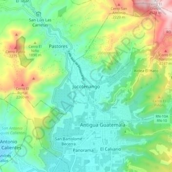
Name: Jocotenango topographic map, elevation, terrain.
Location: Jocotenango, Sacatepéquez, 03002, Guatemala (14.53474 -90.78167 14.61474 -90.70167)
Average elevation: 5,768 ft
Minimum elevation: 4,780 ft
Maximum elevation: 8,176 ft
Thank you for supporting this site ❤️
Make a donation
Make a donation
Gear up for your next adventure:
As an Amazon Associate, this site earns from qualifying purchases at no extra cost to you.