
Thank you for supporting this site ❤️
Make a donation
Make a donation
Gear up for your next adventure:
As an Amazon Associate, this site earns from qualifying purchases at no extra cost to you.
Boltaña topographic map
Click on the map to display elevation.
Thank you for supporting this site ❤️
Make a donation
Make a donation
Gear up for your next adventure:
As an Amazon Associate, this site earns from qualifying purchases at no extra cost to you.
About this map
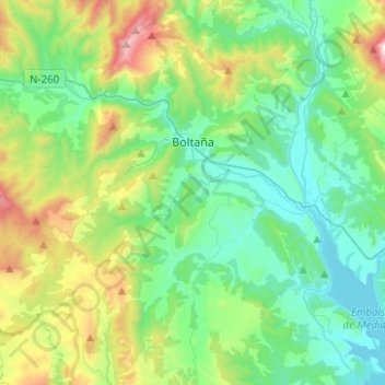
Name: Boltaña topographic map, elevation, terrain.
Location: Boltaña, Sobrarbe, Huesca, Aragon, Spain (42.33969 -0.13006 42.50286 0.11904)
Average elevation: 2,822 ft
Minimum elevation: 1,663 ft
Maximum elevation: 6,181 ft
Thank you for supporting this site ❤️
Make a donation
Make a donation
Gear up for your next adventure:
As an Amazon Associate, this site earns from qualifying purchases at no extra cost to you.