
Thank you for supporting this site ❤️
Make a donation
Make a donation
Gear up for your next adventure:
As an Amazon Associate, this site earns from qualifying purchases at no extra cost to you.
Mandach topographic map
Click on the map to display elevation.
Thank you for supporting this site ❤️
Make a donation
Make a donation
Gear up for your next adventure:
As an Amazon Associate, this site earns from qualifying purchases at no extra cost to you.
About this map
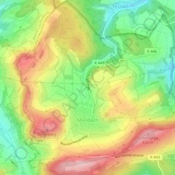
Name: Mandach topographic map, elevation, terrain.
Location: Mandach, Bezirk Brugg, Aargau, 5318, Switzerland (47.53840 8.16972 47.56525 8.20793)
Average elevation: 1,696 ft
Minimum elevation: 1,342 ft
Maximum elevation: 2,087 ft
Thank you for supporting this site ❤️
Make a donation
Make a donation
Gear up for your next adventure:
As an Amazon Associate, this site earns from qualifying purchases at no extra cost to you.