
Thank you for supporting this site ❤️
Make a donation
Make a donation
Gear up for your next adventure:
As an Amazon Associate, this site earns from qualifying purchases at no extra cost to you.
Calsazio topographic map
Click on the map to display elevation.
Thank you for supporting this site ❤️
Make a donation
Make a donation
Gear up for your next adventure:
As an Amazon Associate, this site earns from qualifying purchases at no extra cost to you.
About this map
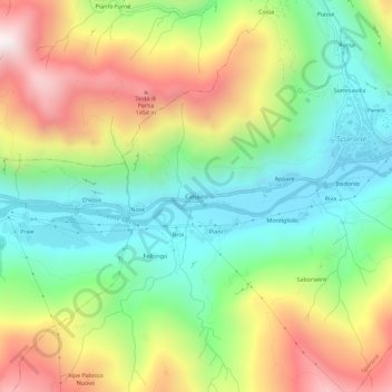
Name: Calsazio topographic map, elevation, terrain.
Location: Calsazio, Sparone, Torino, Piemonte, Italia (45.38795 7.50088 45.42795 7.54088)
Average elevation: 3,064 ft
Minimum elevation: 1,686 ft
Maximum elevation: 5,144 ft
Thank you for supporting this site ❤️
Make a donation
Make a donation
Gear up for your next adventure:
As an Amazon Associate, this site earns from qualifying purchases at no extra cost to you.