Geolocate

Edgewood topographic map

Click on the map to display elevation.

About this map

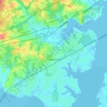
Name: Edgewood topographic map, elevation, terrain.

Location: Edgewood, Harford County, Maryland, United States (39.38041 -76.34871 39.46149 -76.24735)

Average elevation: 39 ft

Minimum elevation: -13 ft

Maximum elevation: 190 ft

Harford County trails, hiking, mountain biking, running and outdoor activities

Gear up for your next adventure:

🪵Folding Camp Saw - Compact saw for wood and campsite work
🥇GPS Hiking Watch - Multi‑sport GPS watch with navigation and trail tracking
🔦LED Headlamp - Bright and durable LED headlamp for night navigation
🎒Day Hiking Backpack - Lightweight backpack perfect for day trips and outdoor adventures
🔦Compact Flashlight - Reliable flashlight for emergencies

As an Amazon Associate, this site earns from qualifying purchases at no extra cost to you.