Geolocate

Nandankanan topographic map

Click on the map to display elevation.

About this map

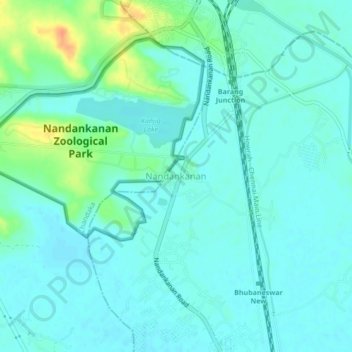
Name: Nandankanan topographic map, elevation, terrain.

Location: Nandankanan, Khordha, Odisha, 754005, India (20.37373 85.80543 20.41373 85.84543)

Average elevation: 89 ft

Minimum elevation: 59 ft

Maximum elevation: 190 ft

Gear up for your next adventure:

🧷Carabiner Set - Durable clips for gear attachment
🛠️Backpacking Tool Kit - Essential toolkit for outdoor repairs
🧤Tactile Hiking Gloves - Keep hands warm while operating GPS and smartphone screens
🌐World Map Poster - Decorative world maps with topographic info
🛶Inflatable Kayak - Portable kayak for rivers, lakes, and expeditions

As an Amazon Associate, this site earns from qualifying purchases at no extra cost to you.