
Thank you for supporting this site ❤️
Make a donation
Make a donation
Gear up for your next adventure:
As an Amazon Associate, this site earns from qualifying purchases at no extra cost to you.
Fil`ah topographic map
Click on the map to display elevation.
Thank you for supporting this site ❤️
Make a donation
Make a donation
Gear up for your next adventure:
As an Amazon Associate, this site earns from qualifying purchases at no extra cost to you.
About this map
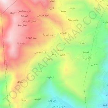
Name: Fil`ah topographic map, elevation, terrain.
Location: Fil`ah, رقاد, As Sayyani District, Ibb Governorate, Yemen (13.83376 44.13137 13.87376 44.17137)
Average elevation: 7,641 ft
Minimum elevation: 5,974 ft
Maximum elevation: 9,324 ft
Thank you for supporting this site ❤️
Make a donation
Make a donation
Gear up for your next adventure:
As an Amazon Associate, this site earns from qualifying purchases at no extra cost to you.