Geolocate

Welver topographic map

Click on the map to display elevation.

About this map

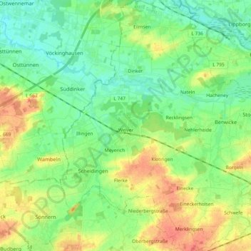
Name: Welver topographic map, elevation, terrain.

Location: Welver, Kreis Soest, North Rhine-Westphalia, 59514, Germany (51.56309 7.90954 51.67579 8.09042)

Average elevation: 256 ft

Minimum elevation: 200 ft

Maximum elevation: 341 ft

Other topographic maps

Click on a map to view its topography, its elevation and its terrain.

Körbecke

Germany > North Rhine-Westphalia > Kreis Soest

Average elevation: 817 ft

Gear up for your next adventure:

🔌Solar Panel Charger - Charge gear sustainably outdoors
🪶Survival Guide Book - Expert advice for emergency preparedness
🪶LED Camping Lantern - Bright lantern for camp lighting
🧴Hand Sanitizer - Keep hands clean while hiking
🥩Freeze-Dried Meals - Nutritious and lightweight food for remote expeditions

As an Amazon Associate, this site earns from qualifying purchases at no extra cost to you.