
Thank you for supporting this site ❤️
Make a donation
Make a donation
Gear up for your next adventure:
As an Amazon Associate, this site earns from qualifying purchases at no extra cost to you.
Barla topographic map
Click on the map to display elevation.
Thank you for supporting this site ❤️
Make a donation
Make a donation
Gear up for your next adventure:
As an Amazon Associate, this site earns from qualifying purchases at no extra cost to you.
About this map
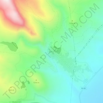
Name: Barla topographic map, elevation, terrain.
Location: Barla, Eğirdir, Isparta, Mediterranean Region, Turkey (37.99914 30.76163 38.03914 30.80163)
Average elevation: 3,924 ft
Minimum elevation: 3,054 ft
Maximum elevation: 5,856 ft
Thank you for supporting this site ❤️
Make a donation
Make a donation
Gear up for your next adventure:
As an Amazon Associate, this site earns from qualifying purchases at no extra cost to you.