
Thank you for supporting this site ❤️
Make a donation
Make a donation
Gear up for your next adventure:
As an Amazon Associate, this site earns from qualifying purchases at no extra cost to you.
Grandcourt topographic map
Click on the map to display elevation.
Thank you for supporting this site ❤️
Make a donation
Make a donation
Gear up for your next adventure:
As an Amazon Associate, this site earns from qualifying purchases at no extra cost to you.
About this map
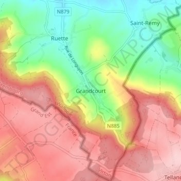
Name: Grandcourt topographic map, elevation, terrain.
Location: Grandcourt, Virton, Luxemburg, Wallonië, België (49.50609 5.58445 49.54609 5.62445)
Average elevation: 1,033 ft
Minimum elevation: 715 ft
Maximum elevation: 1,322 ft
Thank you for supporting this site ❤️
Make a donation
Make a donation
Gear up for your next adventure:
As an Amazon Associate, this site earns from qualifying purchases at no extra cost to you.