Geolocate

Hatfield Forest topographic map

Click on the map to display elevation.

About this map

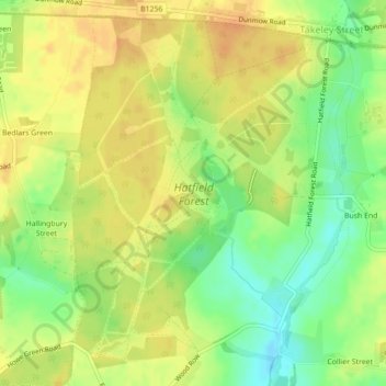
Name: Hatfield Forest topographic map, elevation, terrain.

Location: Hatfield Forest, Takeley Street, Uttlesford, Essex, East of England, England, CM22 6NH, United Kingdom (51.84444 0.21699 51.86888 0.24692)

Average elevation: 295 ft

Minimum elevation: 230 ft

Maximum elevation: 335 ft

Other topographic maps

Click on a map to view its topography, its elevation and its terrain.

Gear up for your next adventure:

📌Outdoor GPS Map App - Apps and devices for digital topographic navigation
🎒Gear Packing Cubes - Organize your backpack efficiently
🕶️GPS Smartphone Mount - Secure mount for phone navigation
🎒Trekking Poles - Sturdy poles for balance and stability on rough terrain
🧣Hiking Neck Gaiter - Multi‑use neck protection for outdoor weather

As an Amazon Associate, this site earns from qualifying purchases at no extra cost to you.