Geolocate

Parasnath topographic map

Click on the map to display elevation.

About this map

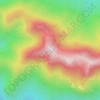
Name: Parasnath topographic map, elevation, terrain.

Location: Parasnath, Pirtanr, Giridih, Jharkhand, India (23.96357 86.12852 23.96367 86.12862)

Average elevation: 3,278 ft

Minimum elevation: 2,018 ft

Maximum elevation: 4,439 ft

Other topographic maps

Click on a map to view its topography, its elevation and its terrain.

Pirtanr

India > Jharkhand > Pirtanr

Average elevation: 1,089 ft

Gear up for your next adventure:

🌡️Handheld Weather Meters - Measure wind, temp, and pressure for safe mountain travel
🛌Ultralight Sleeping Bags - Compact down bags for cold nights in the wilderness
🛶Inflatable Kayak - Portable kayak for rivers, lakes, and expeditions
🎒Trekking Poles - Sturdy poles for balance and stability on rough terrain
🛠️Outdoor Gear Repair Kit - Essential tools to fix gear on the trail

As an Amazon Associate, this site earns from qualifying purchases at no extra cost to you.