Geolocate

Kiambu topographic map

Click on the map to display elevation.

About this map

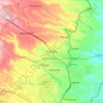
Name: Kiambu topographic map, elevation, terrain.

Location: Kiambu, Central Kenya, 00900, Kenya (-1.20639 36.78528 -1.12639 36.86528)

Average elevation: 5,646 ft

Minimum elevation: 5,190 ft

Maximum elevation: 6,125 ft

Gear up for your next adventure:

🎒Waterproof Dry Bags - Keep your electronics and maps dry inside your pack
🚪Portable Camp Chair - Foldable chair for comfort at camp
🧢Sun Protection Hats - Wide-brimmed and UPF-rated hats for high-altitude sun safety
🦺Reflective Outdoor Gear - Safety gear for low‑light conditions
🪶Compact Camp Shovel - Folding shovel for campsite tasks

As an Amazon Associate, this site earns from qualifying purchases at no extra cost to you.