
Thank you for supporting this site ❤️
Make a donation
Make a donation
Gear up for your next adventure:
As an Amazon Associate, this site earns from qualifying purchases at no extra cost to you.
Didsbury topographic map
Click on the map to display elevation.
Thank you for supporting this site ❤️
Make a donation
Make a donation
Gear up for your next adventure:
As an Amazon Associate, this site earns from qualifying purchases at no extra cost to you.
About this map
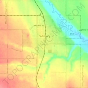
Name: Didsbury topographic map, elevation, terrain.
Location: Didsbury, Alberta, T0M 0W0, Canada (51.63508 -114.17901 51.67846 -114.10776)
Average elevation: 3,412 ft
Minimum elevation: 3,287 ft
Maximum elevation: 3,517 ft
Thank you for supporting this site ❤️
Make a donation
Make a donation
Gear up for your next adventure:
As an Amazon Associate, this site earns from qualifying purchases at no extra cost to you.