
Littleton topographic map
Click on the map to display elevation.
Littleton
Littleton is located at 39°35′59″N 105°0′39″W / 39.59972°N 105.01083°W / 39.59972; -105.01083 (39.599691, −105.010929) at an elevation of 5,351 feet (1,631 m). Located in central Colorado at the junction of U.S. Route 85 and Colorado State Highway 470, the city is 9 miles (14 km) south of downtown Denver and 55 miles (89 km) north of Colorado Springs.
About this map
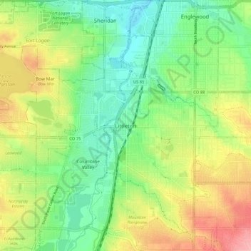
Name: Littleton topographic map, elevation, terrain.
Average elevation: 5,433 ft
Minimum elevation: 5,266 ft
Maximum elevation: 5,692 ft
Arapahoe County trails, hiking, mountain biking, running and outdoor activities