
Thank you for supporting this site ❤️
Make a donation
Make a donation
Gear up for your next adventure:
As an Amazon Associate, this site earns from qualifying purchases at no extra cost to you.
东嘎街道 topographic map
Click on the map to display elevation.
Thank you for supporting this site ❤️
Make a donation
Make a donation
Gear up for your next adventure:
As an Amazon Associate, this site earns from qualifying purchases at no extra cost to you.
About this map
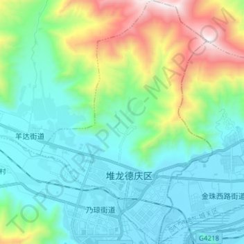
Name: 东嘎街道 topographic map, elevation, terrain.
Location: 东嘎街道, 堆龙德庆区, Lhasa, Tibet, China (29.61825 90.95616 29.72638 91.04403)
Average elevation: 13,238 ft
Minimum elevation: 11,913 ft
Maximum elevation: 17,562 ft
Thank you for supporting this site ❤️
Make a donation
Make a donation
Gear up for your next adventure:
As an Amazon Associate, this site earns from qualifying purchases at no extra cost to you.