Geolocate

Redding topographic map

Click on the map to display elevation.

About this map

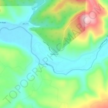
Name: Redding topographic map, elevation, terrain.

Location: Redding, Franklin County, Arkansas, United States (35.66008 -93.79714 35.70008 -93.75714)

Average elevation: 1,010 ft

Minimum elevation: 725 ft

Maximum elevation: 1,608 ft

Franklin County trails, hiking, mountain biking, running and outdoor activities

Gear up for your next adventure:

🌧️Backpack Rain Cover - Keep gear dry in wet weather
📶Satellite Messenger - Communication device off‑grid
🏕️Tent Footprint - Protect your tent base from wear
🛠️Outdoor Gear Repair Kit - Essential tools to fix gear on the trail
🧤Tactile Hiking Gloves - Keep hands warm while operating GPS and smartphone screens

As an Amazon Associate, this site earns from qualifying purchases at no extra cost to you.