Geolocate

Vallina topographic map

Click on the map to display elevation.

About this map

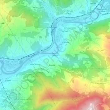
Name: Vallina topographic map, elevation, terrain.

Location: Vallina, Bagno a Ripoli, Florence, Tuscany, 50061, Italy (43.75173 11.34027 43.79173 11.38027)

Average elevation: 676 ft

Minimum elevation: 164 ft

Maximum elevation: 1,834 ft

Gear up for your next adventure:

🛌Ultralight Sleeping Bags - Compact down bags for cold nights in the wilderness
🧭Pro Hiking Compasses - High-accuracy liquid-filled compasses for topographic orientation
📖Nature Tracking Books - Learn to track wildlife and terrain
🧥Waterproof Jacket for Hiking - Breathable and rugged rain jacket for outdoor excursions
🪓Survival Multi‑Tool - Versatile tool for camp and trail tasks

As an Amazon Associate, this site earns from qualifying purchases at no extra cost to you.