
Thank you for supporting this site ❤️
Make a donation
Make a donation
Gear up for your next adventure:
As an Amazon Associate, this site earns from qualifying purchases at no extra cost to you.
Mlibizi topographic map
Click on the map to display elevation.
Thank you for supporting this site ❤️
Make a donation
Make a donation
Gear up for your next adventure:
As an Amazon Associate, this site earns from qualifying purchases at no extra cost to you.
About this map
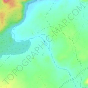
Name: Mlibizi topographic map, elevation, terrain.
Location: Mlibizi, Binga, Matabeleland North Province, Zimbabwe (-18.03131 27.10885 -18.02691 27.11280)
Average elevation: 1,732 ft
Minimum elevation: 1,640 ft
Maximum elevation: 1,926 ft
Thank you for supporting this site ❤️
Make a donation
Make a donation
Gear up for your next adventure:
As an Amazon Associate, this site earns from qualifying purchases at no extra cost to you.