
Mentor topographic map
Click on the map to display elevation.
About this map
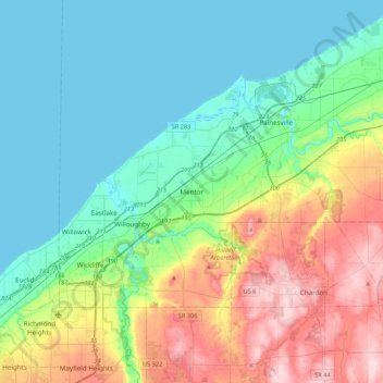
Name: Mentor topographic map, elevation, terrain.
Location: Mentor, Lake County, Ohio, 44060, United States (41.50648 -81.49998 41.82648 -81.17998)
Average elevation: 794 ft
Minimum elevation: 564 ft
Maximum elevation: 1,365 ft
Lake County trails, hiking, mountain biking, running and outdoor activities