
Thank you for supporting this site ❤️
Make a donation
Make a donation
Gear up for your next adventure:
As an Amazon Associate, this site earns from qualifying purchases at no extra cost to you.
Lovelock topographic map
Click on the map to display elevation.
Thank you for supporting this site ❤️
Make a donation
Make a donation
Gear up for your next adventure:
As an Amazon Associate, this site earns from qualifying purchases at no extra cost to you.
About this map
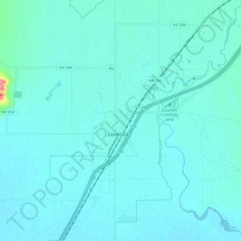
Name: Lovelock topographic map, elevation, terrain.
Location: Lovelock, Pershing County, Nevada, 89417, United States (40.14474 -118.51377 40.22474 -118.43377)
Average elevation: 3,983 ft
Minimum elevation: 3,944 ft
Maximum elevation: 4,393 ft
Pershing County trails, hiking, mountain biking, running and outdoor activities
Thank you for supporting this site ❤️
Make a donation
Make a donation
Gear up for your next adventure:
As an Amazon Associate, this site earns from qualifying purchases at no extra cost to you.