Geolocate

Wolsey topographic map

Click on the map to display elevation.

About this map

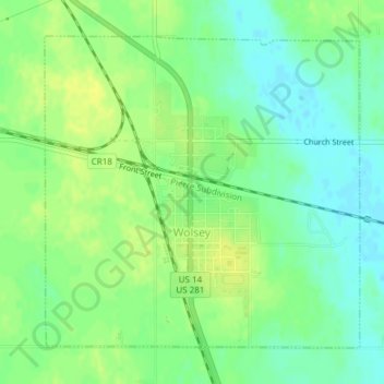
Name: Wolsey topographic map, elevation, terrain.

Location: Wolsey, Beadle County, South Dakota, 57384, United States (44.39960 -98.48933 44.42157 -98.45826)

Average elevation: 1,342 ft

Minimum elevation: 1,309 ft

Maximum elevation: 1,368 ft

Beadle County trails, hiking, mountain biking, running and outdoor activities

Gear up for your next adventure:

🧭Map Reading Tools - Tools and kits for map navigation
🪑Portable Camp Table - Compact table for campsite meals
📦Gear Storage Bags - Organize and protect outdoor equipment
🎒Trail Energy Bars - High‑calorie bars for hiking energy
🪑Ultralight Camp Chairs - Portable seating for resting after a long day of mapping

As an Amazon Associate, this site earns from qualifying purchases at no extra cost to you.