Geolocate

Girawan topographic map

Click on the map to display elevation.

About this map

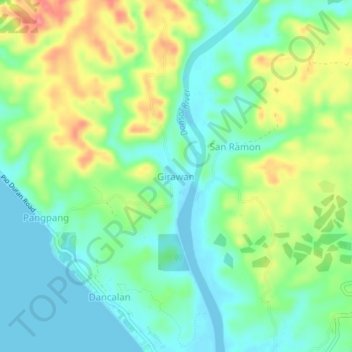
Name: Girawan topographic map, elevation, terrain.

Location: Girawan, Donsol, Sorsogon, Bicol Region, 4715, Philippines (12.91665 123.56668 12.95665 123.60668)

Average elevation: 92 ft

Minimum elevation: -10 ft

Maximum elevation: 262 ft

Gear up for your next adventure:

🪶Paracord Bracelet - Survival bracelet with built‑in tools
🧥Men's Rain Shells - Premium waterproof and breathable jackets for mountain weather
🪶Fire Starter Kit - Reliable fire starter for survival and camping
💧Water Filtration Bottles - Safely drink from streams and lakes while exploring
🪶Survival Guide Book - Expert advice for emergency preparedness

As an Amazon Associate, this site earns from qualifying purchases at no extra cost to you.