Geolocate

Saga topographic map

Click on the map to display elevation.

About this map

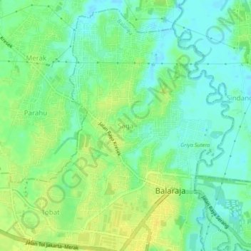
Name: Saga topographic map, elevation, terrain.

Location: Saga, Balaraja, Tangerang Regency, Banten, Java, Indonesia (-6.20089 106.43559 -6.16089 106.47559)

Average elevation: 52 ft

Minimum elevation: 20 ft

Maximum elevation: 89 ft

Gear up for your next adventure:

🚪Portable Camp Chair - Foldable chair for comfort at camp
👖Convertible Hiking Pants - Versatile zip-off pants for changing altitudes and temperatures
🛡️Bear Spray Outdoor - Protection in bear country hikes
👟Men's Trail Runners - Lightweight footwear for fast-paced exploration and light hiking
🧤Hiking Gloves - Protective gloves for rugged trails

As an Amazon Associate, this site earns from qualifying purchases at no extra cost to you.