Geolocate

Sacul topographic map

Click on the map to display elevation.

About this map

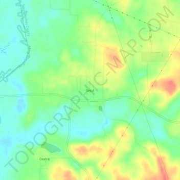
Name: Sacul topographic map, elevation, terrain.

Location: Sacul, Nacogdoches County, Texas, 75788, United States (31.80490 -94.93883 31.84490 -94.89883)

Average elevation: 322 ft

Minimum elevation: 246 ft

Maximum elevation: 427 ft

Nacogdoches County trails, hiking, mountain biking, running and outdoor activities

Gear up for your next adventure:

🛰️Handheld GPS Units - Professional satellite navigators for precise backcountry mapping
🔭Stargazing Telescopes - Perfect for camping in low-light pollution areas shown on maps
🪶Fire Starter Kit - Reliable fire starter for survival and camping
👖Convertible Hiking Pants - Versatile zip-off pants for changing altitudes and temperatures
🗺️NatGeo Topo Maps - High-quality waterproof printed topographic maps of US Parks

As an Amazon Associate, this site earns from qualifying purchases at no extra cost to you.