
Thank you for supporting this site ❤️
Make a donation
Make a donation
Gear up for your next adventure:
As an Amazon Associate, this site earns from qualifying purchases at no extra cost to you.
Mudelos topographic map
Click on the map to display elevation.
Thank you for supporting this site ❤️
Make a donation
Make a donation
Gear up for your next adventure:
As an Amazon Associate, this site earns from qualifying purchases at no extra cost to you.
About this map
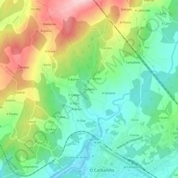
Name: Mudelos topographic map, elevation, terrain.
Location: Mudelos, O Carballiño, Orense, Galicia, 32534, España (42.42819 -8.10190 42.46819 -8.06190)
Average elevation: 1,522 ft
Minimum elevation: 1,201 ft
Maximum elevation: 2,096 ft
Thank you for supporting this site ❤️
Make a donation
Make a donation
Gear up for your next adventure:
As an Amazon Associate, this site earns from qualifying purchases at no extra cost to you.