
Thank you for supporting this site ❤️
Make a donation
Make a donation
Gear up for your next adventure:
As an Amazon Associate, this site earns from qualifying purchases at no extra cost to you.
Rwankeri topographic map
Click on the map to display elevation.
Thank you for supporting this site ❤️
Make a donation
Make a donation
Gear up for your next adventure:
As an Amazon Associate, this site earns from qualifying purchases at no extra cost to you.
About this map
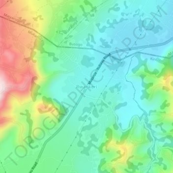
Name: Rwankeri topographic map, elevation, terrain.
Location: Rwankeri, Mukamira, Nyabihu, Western Province, Rwanda (-1.59926 29.50840 -1.55926 29.54840)
Average elevation: 7,579 ft
Minimum elevation: 7,162 ft
Maximum elevation: 8,612 ft
Thank you for supporting this site ❤️
Make a donation
Make a donation
Gear up for your next adventure:
As an Amazon Associate, this site earns from qualifying purchases at no extra cost to you.