
Thank you for supporting this site ❤️
Make a donation
Make a donation
Gear up for your next adventure:
As an Amazon Associate, this site earns from qualifying purchases at no extra cost to you.
Puig-reig topographic map
Click on the map to display elevation.
Thank you for supporting this site ❤️
Make a donation
Make a donation
Gear up for your next adventure:
As an Amazon Associate, this site earns from qualifying purchases at no extra cost to you.
About this map
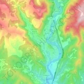
Name: Puig-reig topographic map, elevation, terrain.
Location: Puig-reig, Berguedà, Barcelona, Cataluña, 08692, España (41.95355 1.85753 41.99355 1.89753)
Average elevation: 1,657 ft
Minimum elevation: 1,201 ft
Maximum elevation: 2,257 ft
Thank you for supporting this site ❤️
Make a donation
Make a donation
Gear up for your next adventure:
As an Amazon Associate, this site earns from qualifying purchases at no extra cost to you.