
Thank you for supporting this site ❤️
Make a donation
Make a donation
Gear up for your next adventure:
As an Amazon Associate, this site earns from qualifying purchases at no extra cost to you.
Pachaj topographic map
Click on the map to display elevation.
Thank you for supporting this site ❤️
Make a donation
Make a donation
Gear up for your next adventure:
As an Amazon Associate, this site earns from qualifying purchases at no extra cost to you.
About this map
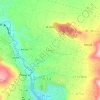
Name: Pachaj topographic map, elevation, terrain.
Location: Pachaj, Cantel, Quetzaltenango, Guatemala (14.81060 -91.46596 14.85060 -91.42596)
Average elevation: 7,949 ft
Minimum elevation: 7,444 ft
Maximum elevation: 8,648 ft
Thank you for supporting this site ❤️
Make a donation
Make a donation
Gear up for your next adventure:
As an Amazon Associate, this site earns from qualifying purchases at no extra cost to you.