Geolocate

Glencoe topographic map

Click on the map to display elevation.

About this map

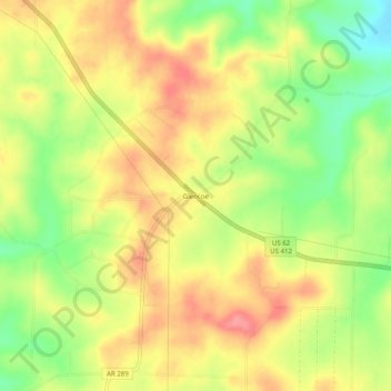
Name: Glencoe topographic map, elevation, terrain.

Location: Glencoe, Fulton County, Arkansas, 72539, United States (36.27423 -91.76737 36.31423 -91.72737)

Average elevation: 764 ft

Minimum elevation: 610 ft

Maximum elevation: 889 ft

Fulton County trails, hiking, mountain biking, running and outdoor activities

Gear up for your next adventure:

🥄Camping Utensil Set - Lightweight utensils for outdoor meals
🧤Hiking Gloves - Protective gloves for rugged trails
🦟Ultrasonic Repellers - Create a bug-free zone at your camp or rest stop
🥾Men's Hiking Boots - Durable, waterproof footwear for rugged terrain and steep inclines
🧴Hand Sanitizer - Keep hands clean while hiking

As an Amazon Associate, this site earns from qualifying purchases at no extra cost to you.