Geolocate

Rustavi topographic map

Click on the map to display elevation.

About this map

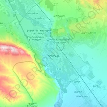
Name: Rustavi topographic map, elevation, terrain.

Location: Rustavi, Lower Kartli, 3700, Georgia (41.49106 44.89030 41.60117 45.08626)

Average elevation: 1,329 ft

Minimum elevation: 978 ft

Maximum elevation: 2,503 ft

Gear up for your next adventure:

💧Water Purification System - Clean water on the trail with reliable purifiers
🪶Wildlife Field Guides - Learn animal tracking and species ID
❄️Traction Cleats - Prevent slips on icy trails during winter hikes
🪶Fire Starter Kit - Reliable fire starter for survival and camping
🌐World Map Poster - Decorative world maps with topographic info

As an Amazon Associate, this site earns from qualifying purchases at no extra cost to you.