
Thank you for supporting this site ❤️
Make a donation
Make a donation
Gear up for your next adventure:
As an Amazon Associate, this site earns from qualifying purchases at no extra cost to you.
Premstätten topographic map
Click on the map to display elevation.
Thank you for supporting this site ❤️
Make a donation
Make a donation
Gear up for your next adventure:
As an Amazon Associate, this site earns from qualifying purchases at no extra cost to you.
About this map
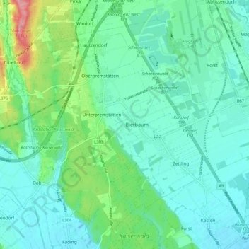
Name: Premstätten topographic map, elevation, terrain.
Location: Premstätten, Bezirk Graz-Umgebung, Styria, 8141, Austria (46.93339 15.36341 46.99306 15.46674)
Average elevation: 1,112 ft
Minimum elevation: 1,030 ft
Maximum elevation: 1,398 ft
Thank you for supporting this site ❤️
Make a donation
Make a donation
Gear up for your next adventure:
As an Amazon Associate, this site earns from qualifying purchases at no extra cost to you.