Geolocate

Chiappera topographic map

Click on the map to display elevation.

About this map

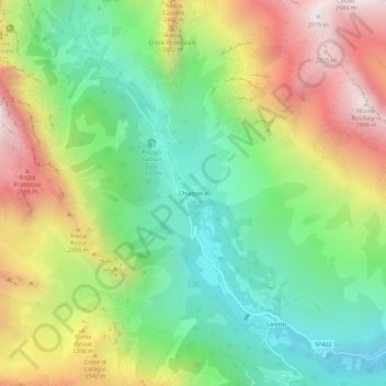
Name: Chiappera topographic map, elevation, terrain.

Location: Chiappera, Acceglio, Cuneo, Piemonte, Italia (44.47222 6.90508 44.51222 6.94508)

Average elevation: 6,667 ft

Minimum elevation: 4,760 ft

Maximum elevation: 9,488 ft

Gear up for your next adventure:

🧦Hiking Socks - Comfortable socks to prevent blisters on long hikes
👓Polarized Sunglasses - Outdoor sunglasses for glare reduction
Backpacking Tent - Lightweight and durable tent for multi‑day hikes
🥇GPS Hiking Watch - Multi‑sport GPS watch with navigation and trail tracking
🔭Compact Binoculars - HD vision for scouting terrain and identifying distant landmarks

As an Amazon Associate, this site earns from qualifying purchases at no extra cost to you.