Geolocate

Germering topographic map

Click on the map to display elevation.

About this map

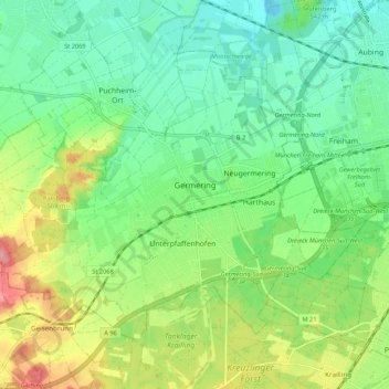
Name: Germering topographic map, elevation, terrain.

Location: Germering, Landkreis Fürstenfeldbruck, Bavaria, 82110, Germany (48.10570 11.30597 48.15867 11.41288)

Average elevation: 1,781 ft

Minimum elevation: 1,677 ft

Maximum elevation: 1,982 ft

Gear up for your next adventure:

🛠️Outdoor Gear Repair Kit - Essential tools to fix gear on the trail
📻Weather Alert Radios - Stay informed of storm risks while off-the-grid
📦Gear Storage Bags - Organize and protect outdoor equipment
🔭Compact Binoculars - HD vision for scouting terrain and identifying distant landmarks
🛶Inflatable Kayak - Portable kayak for rivers, lakes, and expeditions

As an Amazon Associate, this site earns from qualifying purchases at no extra cost to you.