Geolocate

Heinersberg topographic map

Interactive map

Click on the map to display elevation.

About this map

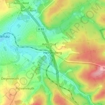
Name: Heinersberg topographic map, elevation, terrain.

Location: Heinersberg, Rehau, Landkreis Hof, Bayern, 95111, Deutschland (50.22382 12.04229 50.26382 12.08229)

Average elevation: 1,860 ft

Minimum elevation: 1,709 ft

Maximum elevation: 2,077 ft

Other topographic maps

Click on a map to view its topography, its elevation and its terrain.

Faßmannsreuth

Deutschland > Bayern > Landkreis Hof > Rehau

Faßmannsreuth, Rehau, Landkreis Hof, Bayern, Deutschland

Average elevation: 2,018 ft

Schönlind

Deutschland > Bayern > Landkreis Hof > Rehau

Schönlind, Rehau, Landkreis Hof, Bayern, 95173, Deutschland

Average elevation: 2,024 ft