
Thank you for supporting this site ❤️
Make a donation
Make a donation
Gear up for your next adventure:
As an Amazon Associate, this site earns from qualifying purchases at no extra cost to you.
Tolombón topographic map
Click on the map to display elevation.
Thank you for supporting this site ❤️
Make a donation
Make a donation
Gear up for your next adventure:
As an Amazon Associate, this site earns from qualifying purchases at no extra cost to you.
About this map
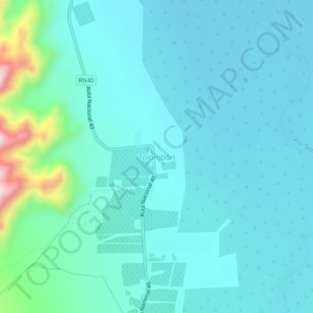
Name: Tolombón topographic map, elevation, terrain.
Location: Tolombón, Cafayate, Salta, Argentina (-26.20275 -65.95984 -26.16275 -65.91984)
Average elevation: 5,413 ft
Minimum elevation: 5,213 ft
Maximum elevation: 6,588 ft
Thank you for supporting this site ❤️
Make a donation
Make a donation
Gear up for your next adventure:
As an Amazon Associate, this site earns from qualifying purchases at no extra cost to you.