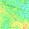
Bandwal topographic map
Click on the map to display elevation.
About this map

Name: Bandwal topographic map, elevation, terrain.
Location: Bandwal, Kahuta Tehsil, Rawalpindi Division, Punjab, Pakistan (33.49769 73.40919 33.53769 73.44919)
Average elevation: 2,300 ft
Minimum elevation: 2,008 ft
Maximum elevation: 2,661 ft
Other topographic maps
Click on a map to view its topography, its elevation and its terrain.

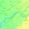
Ravi River
Pakistan > Punjab > Yahya Nagar
The Ravi River originates in the Himalayas in the Multhan tehsil of Kangra district of Himachal Pradesh, India. It follows a north-westerly course and is a perennial river. It is the smallest of the five Punjab rivers that rise from glacier fields at an elevation of 14,000 feet (4,300 m), on the southern side…
Average elevation: 705 ft
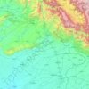
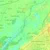

Ravi River
The Ravi River originates in the Himalayas in the Multhan tehsil of Kangra district of Himachal Pradesh, India. It follows a north-westerly course and is a perennial river. It is the smallest of the five Punjab rivers that rise from glacier fields at an elevation of 14,000 feet (4,300 m), on the southern side…
Average elevation: 600 ft

Gujujranwala City Tehsil
Gujranwala sits at the heart of the Rechna Doab, a strip of land between the Chenab in the north, and Ravi River in the south. Gujranwala is also part of the Majha, a historical region of northern Punjab. The city was built upon the plains of Punjab, and the surrounding region is an unbroken plain devoid of…
Average elevation: 738 ft