
Thank you for supporting this site ❤️
Make a donation
Make a donation
Gear up for your next adventure:
As an Amazon Associate, this site earns from qualifying purchases at no extra cost to you.
Mercatello topographic map
Click on the map to display elevation.
Thank you for supporting this site ❤️
Make a donation
Make a donation
Gear up for your next adventure:
As an Amazon Associate, this site earns from qualifying purchases at no extra cost to you.
About this map
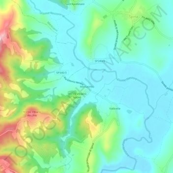
Name: Mercatello topographic map, elevation, terrain.
Location: Mercatello, Marsciano, Perugia, Umbria, 06055, Italia (42.94986 12.24565 42.98986 12.28565)
Average elevation: 817 ft
Minimum elevation: 617 ft
Maximum elevation: 1,365 ft
Thank you for supporting this site ❤️
Make a donation
Make a donation
Gear up for your next adventure:
As an Amazon Associate, this site earns from qualifying purchases at no extra cost to you.