Geolocate

Carthage topographic map

Click on the map to display elevation.

About this map
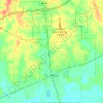
Name: Carthage topographic map, elevation, terrain.

Location: Carthage, Leake County, Mississippi, United States (32.71653 -89.55817 32.77611 -89.50604)

Average elevation: 384 ft

Minimum elevation: 308 ft

Maximum elevation: 505 ft

Leake County trails, hiking, mountain biking, running and outdoor activities

Other topographic maps

Click on a map to view its topography, its elevation and its terrain.

Gray

United States > Mississippi > Leake County

Average elevation: 423 ft

Gear up for your next adventure:

📡GPS Antenna Upgrade - Enhance GPS reception in remote terrain
📶Satellite Messenger - Communication device off‑grid
🧯Emergency Survival Kit - All‑in‑one survival essentials for the backcountry
👟Trail Running Shoes - Lightweight shoes for trail runners
📷Action Cameras - Rugged cameras to document your journeys across rugged terrain

As an Amazon Associate, this site earns from qualifying purchases at no extra cost to you.