Geolocate

Calamello topographic map

Click on the map to display elevation.

About this map

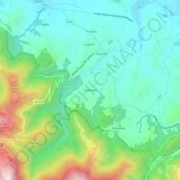
Name: Calamello topographic map, elevation, terrain.

Location: Calamello, Cagli, Pesaro e Urbino, Marche, 61043, Italia (43.50281 12.66427 43.54281 12.70427)

Average elevation: 1,581 ft

Minimum elevation: 909 ft

Maximum elevation: 3,304 ft

Gear up for your next adventure:

🧯Portable Fire Pit - Compact fire pit for camping spots
🌡️Handheld Weather Meters - Measure wind, temp, and pressure for safe mountain travel
🔋Rechargeable Batteries - Power up your outdoor devices
🥇GPS Hiking Watch - Multi‑sport GPS watch with navigation and trail tracking
👟Men's Trail Runners - Lightweight footwear for fast-paced exploration and light hiking

As an Amazon Associate, this site earns from qualifying purchases at no extra cost to you.