Geolocate

Novilara topographic map

Click on the map to display elevation.

About this map

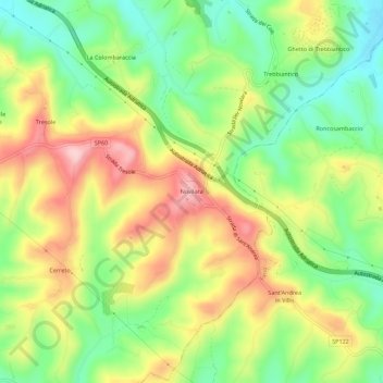
Name: Novilara topographic map, elevation, terrain.

Location: Novilara, Pesaro, Pesaro e Urbino, Marche, Italia (43.84026 12.91070 43.88026 12.95070)

Average elevation: 331 ft

Minimum elevation: 23 ft

Maximum elevation: 709 ft

Gear up for your next adventure:

🦟Ultrasonic Repellers - Create a bug-free zone at your camp or rest stop
📻Weather Alert Radios - Stay informed of storm risks while off-the-grid
🔥Camping Stove - Portable stove for camping and backcountry cooking
🎒Gear Packing Cubes - Organize your backpack efficiently
🧣Merino Neck Gaiters - Multi-functional headwear for wind and sun protection

As an Amazon Associate, this site earns from qualifying purchases at no extra cost to you.