
Thank you for supporting this site ❤️
Make a donation
Make a donation
Gear up for your next adventure:
As an Amazon Associate, this site earns from qualifying purchases at no extra cost to you.
Gavi topographic map
Click on the map to display elevation.
Thank you for supporting this site ❤️
Make a donation
Make a donation
Gear up for your next adventure:
As an Amazon Associate, this site earns from qualifying purchases at no extra cost to you.
About this map
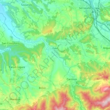
Name: Gavi topographic map, elevation, terrain.
Location: Gavi, Alessandria, Piedmont, 15066, Italy (44.63746 8.74355 44.72461 8.88956)
Average elevation: 1,004 ft
Minimum elevation: 515 ft
Maximum elevation: 2,260 ft
Thank you for supporting this site ❤️
Make a donation
Make a donation
Gear up for your next adventure:
As an Amazon Associate, this site earns from qualifying purchases at no extra cost to you.