Geolocate

Oscoroque topographic map

Click on the map to display elevation.

About this map

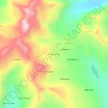
Name: Oscoroque topographic map, elevation, terrain.

Location: Oscoroque, Crucero, Carabaya, Puno, Perú (-14.29941 -69.94033 -14.25941 -69.90033)

Average elevation: 15,633 ft

Minimum elevation: 14,692 ft

Maximum elevation: 16,716 ft

Other topographic maps

Click on a map to view its topography, its elevation and its terrain.

Laguna Azul Cocha

Perú > Puno > Crucero > Chacamarca

Average elevation: 16,017 ft

Gear up for your next adventure:

🦟Ultrasonic Repellers - Create a bug-free zone at your camp or rest stop
🧯Portable Fire Pit - Compact fire pit for camping spots
🚑Emergency Bivvies - Heat-reflective sleeping bags for survival situations
📦Dry Bags Set - Waterproof storage for electronics and clothes
🪶Multi‑Purpose Knife - Useful blade for camp and trail

As an Amazon Associate, this site earns from qualifying purchases at no extra cost to you.