
Thank you for supporting this site ❤️
Make a donation
Make a donation
Gear up for your next adventure:
As an Amazon Associate, this site earns from qualifying purchases at no extra cost to you.
Malabrigo topographic map
Click on the map to display elevation.
Thank you for supporting this site ❤️
Make a donation
Make a donation
Gear up for your next adventure:
As an Amazon Associate, this site earns from qualifying purchases at no extra cost to you.
About this map
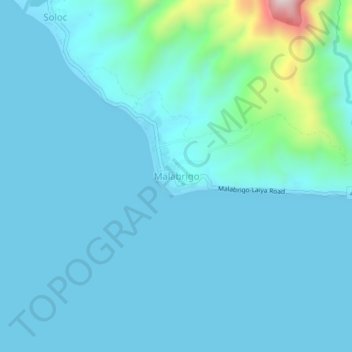
Name: Malabrigo topographic map, elevation, terrain.
Location: Malabrigo, Lobo, Batangas, Calabarzon, Philippines (13.57979 121.24045 13.61979 121.28045)
Average elevation: 184 ft
Minimum elevation: 0 ft
Maximum elevation: 1,814 ft
Thank you for supporting this site ❤️
Make a donation
Make a donation
Gear up for your next adventure:
As an Amazon Associate, this site earns from qualifying purchases at no extra cost to you.