Geolocate

Basaseachi topographic map

Click on the map to display elevation.

About this map

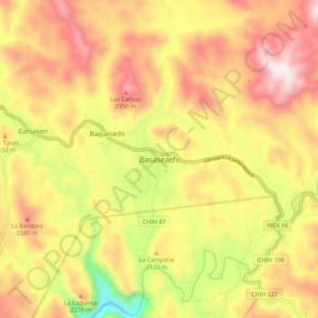
Name: Basaseachi topographic map, elevation, terrain.

Location: Basaseachi, Ocampo, Chihuahua, Mexico (28.16831 -108.24775 28.24831 -108.16775)

Average elevation: 6,916 ft

Minimum elevation: 5,154 ft

Maximum elevation: 8,337 ft

Gear up for your next adventure:

🔦Powerful Headlamps - Ultra-bright hands-free lighting for night navigation
🏕️Family Camping Gear - Essentials for group camping trips
🪵Folding Camp Saw - Compact saw for wood and campsite work
🧤Tactile Hiking Gloves - Keep hands warm while operating GPS and smartphone screens
📚USA Hiking Guide Books - Top trail guides and map books

As an Amazon Associate, this site earns from qualifying purchases at no extra cost to you.