
La Division topographic map
Interactive map
Click on the map to display elevation.
About this map
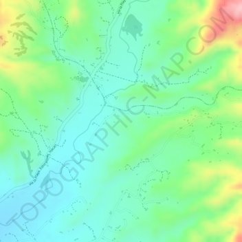
Name: La Division topographic map, elevation, terrain.
Location: La Division, Abrego, Norte de Santander, Colombia (8.15738 -73.26078 8.17738 -73.24078)
Average elevation: 4,518 ft
Minimum elevation: 4,337 ft
Maximum elevation: 4,908 ft
Other topographic maps
Click on a map to view its topography, its elevation and its terrain.
El Carmen
El Carmen, Occidente, Norte de Santander, RAP Gran Santander, Colombia
Average elevation: 1,732 ft