Geolocate

Covington topographic map

Click on the map to display elevation.

About this map

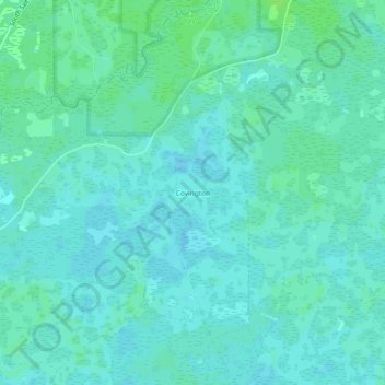
Name: Covington topographic map, elevation, terrain.

Location: Covington, Taylor County, Florida, 32336, United States (30.24854 -83.85071 30.28854 -83.81071)

Average elevation: 39 ft

Minimum elevation: 26 ft

Maximum elevation: 56 ft

Taylor County trails, hiking, mountain biking, running and outdoor activities

Other topographic maps

Click on a map to view its topography, its elevation and its terrain.

Perry

United States > Florida > Taylor County

Average elevation: 52 ft

Perry

United States > Florida > Taylor County

Average elevation: 52 ft

channel

United States > Florida > Taylor County > Keaton Beach

Average elevation: 0 ft

Gear up for your next adventure:

📚USA Hiking Guide Books - Top trail guides and map books
🛡️Insect Repellent - Protection against bugs during outdoor activities
🎁Geography Themed Gifts - Unique gift ideas for map lovers and geography enthusiasts
🧼Biodegradable Camping Soap - Eco‑friendly soap for outdoor hygiene
🧥Men's Rain Shells - Premium waterproof and breathable jackets for mountain weather

As an Amazon Associate, this site earns from qualifying purchases at no extra cost to you.