Geolocate

Lochau topographic map

Click on the map to display elevation.

About this map

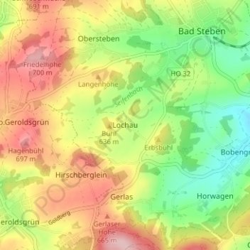
Name: Lochau topographic map, elevation, terrain.

Location: Lochau, Bad Steben, Landkreis Hof, Bayern, 95138, Deutschland (50.33103 11.60442 50.37103 11.64442)

Average elevation: 2,011 ft

Minimum elevation: 1,716 ft

Maximum elevation: 2,333 ft

Gear up for your next adventure:

🧭Orienteering Set - Complete compass and map reading kit
🚁Photography Drones - Capture stunning aerial views of landforms and topography
🔌Solar Panel Charger - Charge gear sustainably outdoors
🖼️Topo Map Wall Art - Decorative topographic prints of famous peaks and regions
Camping Coffee Makers - Enjoy premium coffee at the summit or campsite

As an Amazon Associate, this site earns from qualifying purchases at no extra cost to you.